

Article Summary
Pen y Fan is the highest mountain in southern Britain, standing at 886 metres (2,907 feet) in the heart of the Brecon Beacons National Park. This iconic flat topped peak attracts over 350,000 walkers annually, making it one of the most climbed mountains in Wales. This comprehensive guide covers everything you need to know about climbing Pen y Fan from the Storey Arms car park, including the history of the mountain, detailed route information, the mysterious Llyn Cwm Llwch lake with its legendary island, and practical advice for a safe and enjoyable ascent.
The Monarch of South Wales
Pen y Fan rises above the Brecon Beacons like a great natural throne, its distinctive flat summit and dramatic northern escarpment creating a silhouette that has become synonymous with Welsh mountain walking. This is the highest ground for many miles in any direction, the culmination of a long ridge that forms the spine of the Brecon Beacons and offers some of the finest hill walking in Britain.
The mountain’s name translates from Welsh as “top of the peak” or “head of the beacon,” a straightforward description that belies the complexity of feeling this summit inspires. To stand on Pen y Fan on a clear day is to survey a kingdom of hills, valleys, and distant horizons that seems to extend forever. The Black Mountains rise to the east, the Fforest Fawr wilderness spreads to the west, and on exceptional days the peaks of Snowdonia are visible far to the north.
Yet Pen y Fan is more than simply a viewpoint. The mountain holds a special place in Welsh consciousness, serving as a rite of passage for aspiring hill walkers, a training ground for military selection courses, and a pilgrimage site for those seeking the particular satisfaction that comes from reaching the highest point available. The summit cairn has witnessed proposals, memorial scatterings, and countless moments of quiet triumph as walkers complete their ascent.
The popularity of Pen y Fan has made it one of the busiest mountains in Wales, with the path from Storey Arms carrying a continuous stream of walkers on fine weekends. This accessibility is both blessing and curse, democratising the mountain experience while creating erosion challenges and occasional crowding that can diminish the sense of wilderness. Yet even on the busiest days, Pen y Fan retains its grandeur, the scale of the landscape absorbing the human presence and offering solitude to those who venture beyond the main path.
For those new to mountain walking, Pen y Fan provides an achievable challenge with genuine rewards. For experienced walkers, it offers a quick hit of mountain air or the starting point for longer expeditions across the Brecon Beacons ridge. For everyone, it stands as proof that southern Britain possesses mountain landscapes worthy of celebration.
Geography and Geology

Understanding the physical character of Pen y Fan enriches any visit, revealing the processes that created this remarkable landscape and explaining the distinctive features visible from summit to valley floor.
The Mountain
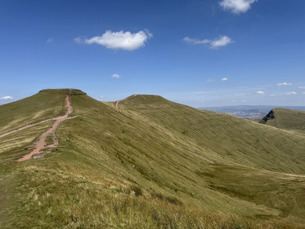
Pen y Fan stands at 886 metres (2,907 feet), making it the highest peak in southern Britain and the highest point in any British county south of Snowdonia. The mountain forms the culmination of a long ridge running east to west through the central Brecon Beacons, with neighbouring peaks including Corn Du (873 metres) immediately to the west and Cribyn (795 metres) to the east.
The summit itself is surprisingly flat, a characteristic shared with Corn Du that gives both peaks their distinctive table top appearance when viewed from a distance. This flat top results from a cap of hard sandstone that has resisted erosion while softer rocks below have been worn away. The summit plateau measures approximately 100 metres across, providing ample space for the many walkers who gather here on busy days.
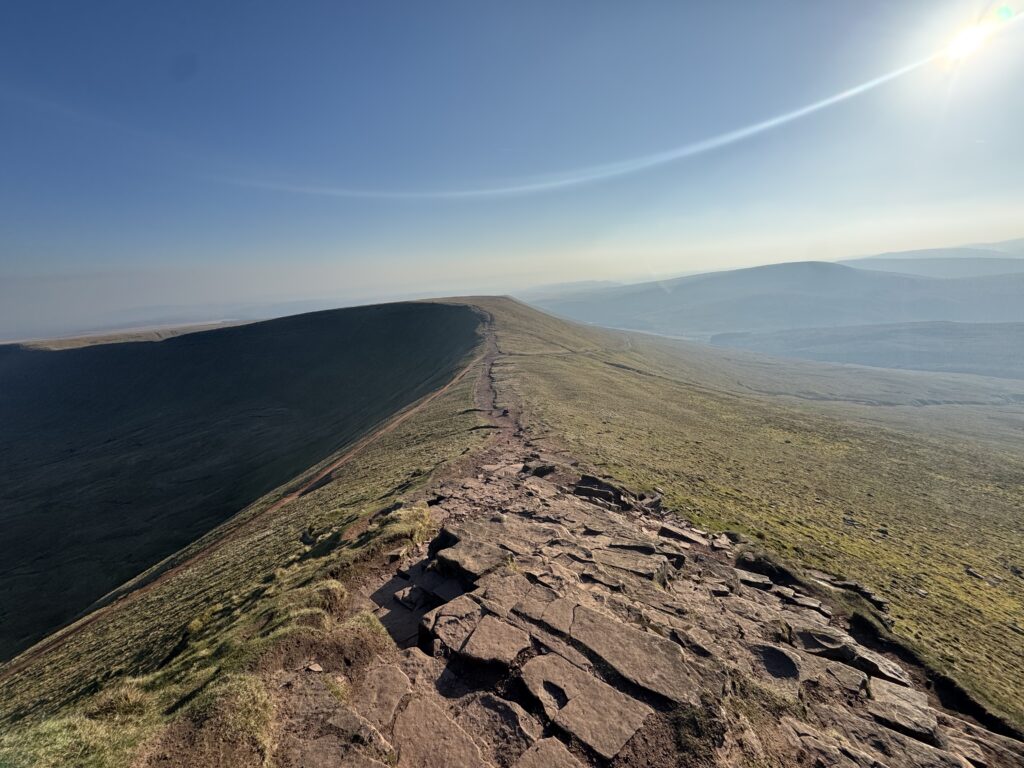
The northern face of Pen y Fan presents a dramatically different aspect from the gentle southern slopes. Here, the mountain falls away in a series of steep cliffs and scree slopes that plunge into the glacial cwms below. This escarpment, carved by ice age glaciers, creates the dramatic profile that makes Pen y Fan instantly recognisable from the north.
Glacial Landscape
The Brecon Beacons were heavily glaciated during the ice ages, and the evidence of this frozen past shapes every aspect of the landscape. The northern escarpment of Pen y Fan owes its dramatic form to glacial erosion, with ice carving into the mountainside to create the cwms (cirques) that bite into the ridge.
Cwm Llwch, the great hollow immediately northwest of Pen y Fan, provides the finest example of glacial erosion in the Brecon Beacons. This amphitheatre like basin was carved by a glacier that accumulated snow and ice on the shaded northern slopes, gradually excavating the mountainside through freeze thaw action and the grinding movement of ice. The steep headwall of the cwm rises directly to the summit ridge, while the floor of the hollow contains Llyn Cwm Llwch, the highest natural lake in south Wales.
The corrie lake, the moraine deposits that dam it, and the steep backwall rising to the summit represent a textbook example of glacial landforms, making Cwm Llwch a popular destination for geography field trips as well as recreational walkers.
Old Red Sandstone
The Brecon Beacons are composed primarily of Old Red Sandstone, sedimentary rocks laid down approximately 400 million years ago during the Devonian period. At this time, the area that would become Wales lay south of the equator in a semi arid environment, with rivers depositing sand and mud across a vast floodplain.
The resulting sandstone varies in hardness, creating the differential erosion that shapes the modern landscape. The summit plateau of Pen y Fan is capped by a particularly resistant layer known as the Plateau Beds, while softer layers below have eroded more quickly, creating the stepped profile visible on the mountain flanks.
The distinctive red brown colour of the rock reflects the iron content of the original sediments, oxidised over millions of years to create the warm tones that characterise Brecon Beacons geology. This colouration is particularly visible on exposed rock faces and in the path surface itself, where countless boots have worn through the soil to reveal the sandstone beneath.
History and Heritage
Pen y Fan has witnessed human activity for thousands of years, from Bronze Age burials to modern military training, and this history adds depth to any visit.
Ancient History
Archaeological evidence reveals that people have visited Pen y Fan for at least 4,000 years. Bronze Age burial cairns on the summit and neighbouring peaks indicate that these high places held spiritual significance for our ancestors, serving as locations for commemorating the dead and perhaps for ceremonies connected with the sky, weather, and seasons.
The summit cairn on Pen y Fan has been subject to archaeological investigation, revealing evidence of Bronze Age activity beneath later additions. Similar cairns on Corn Du and elsewhere along the ridge suggest that the entire escarpment held importance for prehistoric communities living in the valleys below.
The mountain’s name itself connects to a more recent but still ancient practice. The “beacon” element refers to the use of prominent peaks as signal stations, where fires could be lit to communicate across great distances. This beacon system continued into the medieval period and beyond, with peaks like Pen y Fan forming part of a network that could relay messages across Wales in hours.
Military Training
Pen y Fan has become famous, perhaps notorious, for its role in military selection and training. The Fan Dance, a gruelling march over Pen y Fan and back carrying a weighted pack, forms part of the selection process for the Special Air Service (SAS) and other elite units based at nearby Sennybridge.
The mountain’s proximity to military training areas, its challenging terrain, and its unpredictable weather make it an ideal testing ground for those aspiring to serve in special forces. The route from Storey Arms to the summit and back, repeated against the clock with full equipment, has broken many candidates and built the reputation of those who pass.
This military connection has influenced public perception of Pen y Fan, inspiring some visitors to test themselves against the mountain while perhaps creating unrealistic expectations about the difficulty of a straightforward ascent. The standard walk from Storey Arms is well within the capability of reasonably fit beginners, whatever its role in military selection.
Modern Era
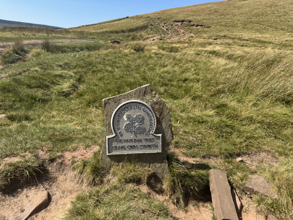
The establishment of the Brecon Beacons National Park in 1957 marked a new chapter in Pen y Fan’s history, recognising the area’s importance for recreation, conservation, and cultural heritage. The national park designation brought both protection and increased visitor numbers, a tension that continues to shape management of the mountain.
The construction of the A470 road through the Storey Arms pass in the twentieth century dramatically improved access to Pen y Fan, bringing the mountain within reach of millions living in south Wales and beyond. The car park at Storey Arms, though basic, transformed what had been a remote peak into an accessible day trip for Cardiff, Swansea, and the valleys towns.
Path erosion became a serious problem as visitor numbers grew, with the original routes becoming braided scars across the hillside. Major restoration work, funded by the national park and conservation organisations, has stabilised the main paths and restored much of the damage, though the work of managing erosion continues.
Llyn Cwm Llwch: The Legendary Lake
Nestled in the dramatic glacial hollow below Pen y Fan’s northern cliffs lies Llyn Cwm Llwch, a small but beautiful lake that holds a significance far beyond its modest size. This tarn, the highest natural lake in south Wales, combines geological interest with legendary status, making it one of the most atmospheric locations in the Brecon Beacons.
The Lake
Llyn Cwm Llwch occupies the floor of Cwm Llwch, the glacial corrie carved into the northern face of Pen y Fan and Corn Du. The lake is roughly circular, approximately 200 metres across, and sits at an elevation of around 600 metres above sea level.
The lake was formed as glacial deposits, known as moraine, dammed the lower end of the cwm, trapping water in the basin carved by the retreating glacier. The moraine ridge remains visible today, a low hump of rocky debris that separates the lake from the steep slopes falling towards the Cwm Llwch valley below.
The water is clear and cold, fed by rainfall and snowmelt draining from the surrounding slopes. The lake supports limited aquatic life due to its altitude and the acidic nature of the water, though it remains an important habitat in its own right.
The setting is spectacular, with the steep headwall of the cwm rising directly from the lakeside to the summit ridge. The cliffs and scree slopes create an amphitheatre effect, with the lake as the stage. On calm days, the summits reflect perfectly in the still water, creating images that have featured in countless photographs and paintings.
The Legend of Llyn Cwm Llwch
Llyn Cwm Llwch is associated with one of the most evocative legends of the Brecon Beacons, a tale of a hidden island, a fairy kingdom, and the consequences of breaking promises.
According to the legend, the lake once contained a small island accessible only on a single day each year, traditionally the first day of May. On this day, a doorway would appear allowing mortals to enter a fairy realm of extraordinary beauty. Those who visited found gardens of unimaginable loveliness, music and dancing, and inhabitants who treated them with great kindness.
The fairies had only one rule: visitors must take nothing from the island. For generations, people respected this condition, enjoying the May Day visits and returning safely to the mortal world. But one year, a greedy visitor concealed a flower from the fairy garden, attempting to carry it back through the doorway.
The theft was discovered, and the consequences were immediate and permanent. The island vanished beneath the waters of the lake, never to reappear. The doorway closed forever, and the connection between the fairy realm and the world of mortals was severed. The lake remains, but the magic is gone, accessible now only through the legend that keeps its memory alive.
Visiting Llyn Cwm Llwch
The lake can be visited as a destination in its own right or incorporated into a circular walk that includes the summit of Pen y Fan. The setting is dramatic and the atmosphere contemplative, quite different from the busy summit.
The standard approach follows the path from Cwm Llwch car park, a smaller facility on the minor road northwest of Pen y Fan. This route approaches the lake from below, climbing gradually through the cwm to reach the water’s edge. The walk to the lake alone takes approximately one hour each way, making it accessible to walkers not wishing to tackle the full summit ascent.
From the lake, a steep path climbs the headwall to reach the ridge between Pen y Fan and Corn Du, allowing the lake visit to be combined with a summit ascent in a rewarding circular walk.
The lake’s legendary status, combined with its beautiful setting, makes it a special place that rewards those who venture beyond the main Storey Arms path. Early morning visits, before other walkers arrive, offer the best chance of solitude and the calmest water for reflections.
The Storey Arms Route
The route from Storey Arms to the summit of Pen y Fan is the most popular approach to the mountain, offering the shortest and most straightforward ascent from a roadside starting point. This path carries the majority of Pen y Fan’s 350,000 annual visitors and has been extensively restored to manage erosion and provide a durable walking surface.
Route Overview
Distance: Approximately 4 kilometres (2.5 miles) each way Ascent: Approximately 450 metres (1,475 feet) Time: Allow 2 to 3 hours for the round trip Difficulty: Moderate, suitable for reasonably fit beginners with appropriate equipment Navigation: Straightforward in clear conditions, more challenging in poor visibility
The Starting Point
The Storey Arms car park lies on the A470 at the highest point of the road between Brecon and Merthyr Tydfil. The name derives from a former coaching inn, the Storey Arms, which stood near this location serving travellers crossing the pass. The building now operates as an outdoor education centre.
The car park provides basic facilities only. There are no toilets, cafes, or shops at the car park itself. The nearest facilities are in Libanus to the north or at the lay bys along the A470 where mobile catering vans sometimes operate.
Parking at Storey Arms is free but limited. On sunny weekends and during school holidays, the car park fills early, often by 9am. Overflow parking along the roadside is prohibited and may result in parking tickets. Alternative car parks at Pont ar Daf (slightly further north) and Cwm Llwch provide options when Storey Arms is full.
The Route in Detail
Stage 1: Car park to the main path (0 to 500 metres)
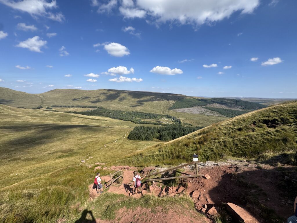
From the car park, cross the A470 with care. The road is busy and vehicles travel fast despite the mountain setting. A clear path leads from the roadside directly towards the mountain, climbing immediately onto the open hillside.
The initial path has been extensively engineered to manage erosion and provide a durable surface. Stone pitching and drainage channels guide walkers along a defined route, and the path is easy to follow in all but the worst visibility.
Stage 2: The lower slopes (500 metres to 1.5 kilometres)
The path climbs steadily through open moorland, gaining height in a series of long traverses across the slope. The gradient is moderate, allowing a sustainable pace that can be maintained without excessive effort.
Views open out as you climb, with the road falling away behind and the mountain bulk rising ahead. The path surface alternates between stone pitching and compacted gravel, well maintained and generally dry underfoot except after heavy rain.
The landscape here is open moorland, dominated by grasses and heather with few features to break the expansive views. On clear days, the distant peaks of the Brecon Beacons ridge become visible to the east and west, while the lowlands of mid Wales spread to the north.
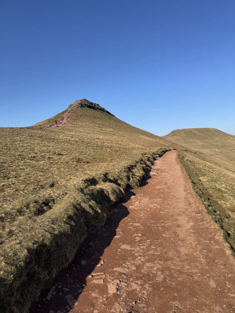
Stage 3: The steepening ascent (1.5 to 2.5 kilometres)
As the path approaches the mountain proper, the gradient increases noticeably. The final section to the summit ridge involves the steepest climbing of the route, with the path zigzagging to ease the ascent.
The character of the landscape changes here, with exposed rock outcrops and scree slopes replacing the grassy moorland of the lower section. The path becomes rockier, requiring more attention to foot placement though remaining well defined.
The summit of Corn Du becomes visible to the left (west), its flat top distinctive against the sky. The path passes close to Corn Du but does not cross its summit, instead continuing along the ridge towards Pen y Fan.
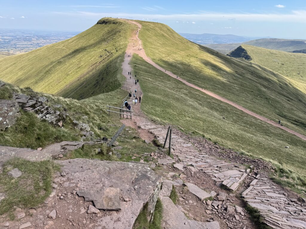
Stage 4: The ridge to the summit (2.5 kilometres to summit)
The path reaches the main ridge between Corn Du and Pen y Fan, and the view suddenly expands to include the dramatic northern escarpment. The glacial cwms fall away to the left, with Llyn Cwm Llwch visible in its hollow below.
From here, the summit is a short walk along the ridge, crossing relatively level ground before a final brief climb to the summit plateau. The path is well defined and the summit cairn visible ahead, removing any navigation concerns in clear weather.
Stage 5: The summit
The summit plateau of Pen y Fan is surprisingly spacious, its flat top providing room for the many walkers who gather here on busy days. The summit cairn, a stone pillar, marks the highest point and serves as the traditional location for summit photographs.
The views from the summit are extensive in all directions:
North: The dramatic northern escarpment falls away to the glacial cwms, with the Black Mountains visible beyond and, on exceptional days, the peaks of Snowdonia on the distant horizon.
South: The gentler southern slopes descend towards the valleys, with the Bristol Channel and Somerset coast visible on clear days.
East: The ridge continues over Cribyn towards the eastern Brecon Beacons and the Black Mountains.
West: Corn Du rises nearby, with the Fforest Fawr wilderness extending towards the Carmarthenshire hills.
The summit can be crowded on fine weekends, with walkers arriving from various routes and lingering to enjoy the views. Those seeking solitude should consider early morning or weekday visits, or continue along the ridge away from the main summit.
The Descent
The descent follows the same route in reverse, retracing the path to the Storey Arms car park. The descent is generally quicker than the ascent, taking approximately 1 to 1.5 hours for most walkers.
Take care on the steeper sections, where the stone pitching can be slippery when wet. The descent is harder on the knees than the ascent, and walking poles can be helpful for those who find downhill walking challenging.
Alternative Routes
While the Storey Arms route is the most popular, several alternative approaches offer different perspectives on Pen y Fan and opportunities to escape the crowds.
The Pont ar Daf Route
Starting from the Pont ar Daf car park, slightly north of Storey Arms on the A470, this route follows a similar line to the Storey Arms path but begins from a marginally less crowded starting point. The additional distance is minimal, and the route joins the main path within the first kilometre.
The Tommy Jones Path
This route approaches from the northwest via the Tommy Jones obelisk, a memorial to a young boy who died on the mountain in 1900. The path is longer and quieter than the Storey Arms route, offering a more wilderness experience.
The Tommy Jones obelisk itself is a poignant landmark, commemorating five year old Tommy Jones who became separated from his father while walking to his grandparents’ farm and was found dead on the mountain 29 days later. The memorial serves as a reminder of the mountain’s potential dangers.
The Cwm Llwch Route
Approaching from the Cwm Llwch car park to the northwest, this route passes Llyn Cwm Llwch before climbing the steep headwall to reach the ridge. The route is longer and more challenging than the Storey Arms approach but offers the reward of visiting the legendary lake.
The ascent from the lake to the ridge is steep and requires good fitness. However, the combination of the lake visit with the summit provides one of the finest walks in the Brecon Beacons.
The Cribyn Ridge
Approaching from the east via the neighbouring peak of Cribyn, this route provides a full ridge walk experience with multiple summits. The route can be started from various points, including the Neuadd Reservoir car park to the south.
This option suits experienced walkers seeking a longer day and a more complete exploration of the Brecon Beacons ridge. The views along the ridge are exceptional, and the sense of achievement in traversing multiple peaks adds to the satisfaction.
Circular Walks Including Pen y Fan
For those seeking more than a simple up and down ascent, several circular routes provide longer walks incorporating Pen y Fan summit.
The Horseshoe Walk
Distance: Approximately 12 kilometres (7.5 miles) Ascent: Approximately 700 metres (2,300 feet) Time: Allow 5 to 6 hours
This classic walk traverses the entire Pen y Fan horseshoe, including Corn Du, Pen y Fan, and Cribyn. The route can be started from Storey Arms or, for a slightly longer walk, from the Neuadd Reservoir car park.
The walk follows the main ridge throughout, providing sustained elevated walking with views in all directions. The descent from Cribyn returns to the starting point via lower paths, completing the horseshoe.
The Cwm Llwch Circular
Distance: Approximately 10 kilometres (6 miles) Ascent: Approximately 650 metres (2,130 feet) Time: Allow 4 to 5 hours
This route combines a visit to Llyn Cwm Llwch with an ascent of Pen y Fan and Corn Du. Starting from the Cwm Llwch car park, the path follows the valley to the lake, climbs the headwall to the ridge, traverses the summits, and descends via the Tommy Jones path or the ridge to the west.
The variety of terrain and the inclusion of the lake make this one of the most rewarding walks in the area.
The Four Peaks
Distance: Approximately 15 kilometres (9.5 miles) Ascent: Approximately 900 metres (2,950 feet) Time: Allow 6 to 7 hours
For fit and experienced walkers, a traverse of the main Brecon Beacons ridge takes in multiple summits including Corn Du, Pen y Fan, Cribyn, and Fan y Big. This expedition provides a full day in the mountains with exceptional views throughout.
The route requires careful navigation and appropriate equipment, but rewards effort with one of the finest ridge walks in Wales.
Practical Information for Walkers
What to Wear
Footwear: Walking boots with ankle support and good grip are recommended. The path is well maintained but includes rocky sections that require sturdy footwear. Trainers are not suitable, particularly in wet conditions.
Clothing: Dress in layers suitable for the conditions. Even in summer, the summit can be significantly colder than the car park, with wind chill reducing temperatures further. Carry a waterproof jacket regardless of the forecast, as weather in the mountains can change quickly.
Winter conditions: Between November and March, snow and ice are possible on the higher ground. In winter conditions, crampons and an ice axe may be necessary, and the walk becomes significantly more serious. Winter walking requires experience and appropriate equipment.
What to Bring
Navigation: A map and compass are essential, along with the knowledge to use them. In poor visibility, the summit plateau can be disorienting, and several parties have become lost despite the well defined paths. OS Explorer OL12 (Brecon Beacons Western Area) covers the route.
Food and water: Carry sufficient food and water for the walk, plus emergency supplies. There are no facilities on the mountain, and the round trip takes several hours during which you will need to eat and drink.
Emergency equipment: Carry a torch, whistle, basic first aid kit, and emergency shelter (survival bag). Mobile phone coverage is variable on the mountain, so do not rely on calling for help.
Sun protection: The summit is exposed, and on clear days the sun can be intense. Carry sunscreen and sunglasses, and consider a hat for protection.
Weather Considerations
Pen y Fan creates its own weather, and conditions on the summit can differ dramatically from those in the valleys below. Key considerations include:
Wind: The exposed summit and ridge are subject to strong winds that can make conditions unpleasant or dangerous. Check the forecast and be prepared to turn back if conditions deteriorate.
Visibility: Cloud frequently covers the summit, reducing visibility to a few metres. Navigation becomes more challenging in poor visibility, and the views that reward the ascent may be absent.
Temperature: The summit is typically 5 to 10 degrees Celsius cooler than the valleys, with wind chill reducing the effective temperature further. Be prepared for conditions significantly colder than expected.
Rain: The Brecon Beacons receive substantial rainfall, and the paths can become streams after heavy rain. Waterproof clothing is essential, and boots should be suitable for wet conditions.
Lightning: The exposed summit is dangerous during thunderstorms. If storms are forecast or develop during your walk, descend immediately to lower ground.
Safety Advice
Tell someone your plans: Before setting out, inform someone of your intended route and expected return time. If you fail to return, they can alert mountain rescue.
Start early: Particularly in winter when daylight hours are limited, start your walk early to allow plenty of time for completion before dark.
Know when to turn back: If conditions deteriorate, you feel unwell, or the walk proves more difficult than expected, turn back. The mountain will still be there another day.
Stay on the path: The erosion restoration work represents significant investment. Staying on the defined paths protects the mountain and makes navigation easier.
Respect other walkers: The mountain is busy, particularly on fine weekends. Be courteous to others and patient at crowded sections.
Facilities
Storey Arms car park: Free parking but limited spaces. No toilets or refreshments. Fills early on busy days.
Pont ar Daf car park: Alternative starting point slightly north of Storey Arms. Similar facilities (none).
Cwm Llwch car park: Smaller car park accessed via minor roads. Quieter starting point for the alternative route via the lake.
Nearest facilities: The nearest toilets, cafes, and shops are in Libanus (north on A470) or the lay bys with mobile catering along the A470. The town of Brecon, approximately 10 miles north, provides full facilities.
Best Time to Visit
Spring (March to May) offers improving weather, longer days, and fewer crowds than summer. The mountain may retain snow into April, and conditions can be wintry early in the season.
Summer (June to August) brings the warmest weather and longest days, ideal for comfortable walking. This is also the busiest period, with the car park filling early and the summit crowded on fine days.
Autumn (September to November) provides quieter conditions and often stable weather. The changing colours add interest to the landscape, and the lower sun creates atmospheric lighting.
Winter (December to February) transforms Pen y Fan into a serious mountain requiring winter skills and equipment. Snow and ice are common, and conditions can be dangerous for the unprepared. However, clear winter days offer exceptional visibility and a genuine mountain experience.
Time of day: Early morning starts avoid the crowds and provide the best chance of clear summit views before clouds develop. The car park is emptier, the paths quieter, and the experience more rewarding. Evening ascents can be beautiful but require careful attention to remaining daylight.
Flora and Fauna
The Brecon Beacons support distinctive plant and animal communities adapted to the upland environment, and observant walkers may encounter various species during their ascent.
Birds
Ravens are the most likely large birds to be encountered, their deep croaking calls carrying across the hillsides. These intelligent corvids patrol the ridges and summits, and their acrobatic flight is a pleasure to watch.
Red kites are now common across mid Wales and are frequently seen soaring above the Brecon Beacons. Their forked tails and reddish brown plumage make them easy to identify.
Meadow pipits are abundant on the moorland, their thin calls and fluttering display flights a constant presence during the breeding season.
Ring ouzels are sometimes seen in the rocky areas, though this mountain blackbird has declined significantly in recent decades.
Peregrine falcons nest on the cliffs and may be seen hunting over the ridges.
Plants
The vegetation on Pen y Fan is typical of upland Wales, with different communities at different altitudes:
Moorland grasses dominate the lower slopes, with mat grass, purple moor grass, and various sedges forming the characteristic upland sward.
Heather occurs in drier areas, adding colour to the landscape when flowering in late summer.
Bilberry (known locally as wimberry) grows on the higher slopes, its small bushes producing edible berries in late summer.
Mosses and lichens thrive in the wet climate, carpeting rocks and creating the green tones that characterise the Welsh uplands.
Arctic alpine plants survive in small numbers on the higher cliffs, relics of the ice age vegetation that once covered these mountains.
Mammals
Sheep are by far the most common mammals encountered, with hardy Welsh mountain sheep grazing throughout the area.
Wild ponies roam parts of the Brecon Beacons, though they are less common in the Pen y Fan area than in some other parts of the range.
Foxes and badgers inhabit the lower slopes, though they are rarely seen during daytime.
Nearby Attractions
The Brecon Beacons area offers numerous attractions beyond Pen y Fan itself, providing options for those seeking variety or alternatives when the weather makes mountain walking inadvisable.
Brecon Town
The historic market town of Brecon lies approximately 10 miles north of Storey Arms and provides:
Shops and services including outdoor equipment stores, cafes, restaurants, and pubs.
Brecon Cathedral is a medieval church of considerable beauty and historical interest.
The Brecon Beacons National Park Visitor Centre at Libanus provides information about the national park and its attractions.
Brecon market operates on Tuesdays and Fridays, selling local produce and general goods.
Waterfalls
The Brecon Beacons contain numerous waterfalls, concentrated particularly in the Waterfall Country area to the west of Pen y Fan:
Sgwd yr Eira allows visitors to walk behind the falling curtain of water.
Sgwd Clun Gwyn, Sgwd Isaf Clun Gwyn, and Sgwd y Pannwr can be visited on a circular walk from Pontneddfechan.
Henrhyd Falls, the highest waterfall in south Wales, plunges 90 feet into a wooded gorge.
Caves
The Brecon Beacons contain extensive cave systems, and several are accessible to visitors:
Dan yr Ogof showcases includes a show cave with impressive formations, a dinosaur park, and other attractions suitable for families.
Porth yr Ogof is the largest cave entrance in Wales, accessible to visitors willing to wade through the river.
Other Walks
The Brecon Beacons offer numerous walking opportunities beyond Pen y Fan:
Fan Brycheiniog and Bannau Sir Gaer in the western Beacons provide quieter alternatives to the busy central peaks.
The Taff Trail cycling and walking route passes through the national park.
The Black Mountains to the east offer extensive ridge walking with a different character from the central Beacons.
Frequently Asked Questions About Pen y Fan
How high is Pen y Fan?
Pen y Fan stands at 886 metres (2,907 feet), making it the highest mountain in southern Britain and the highest point south of Snowdonia.
How long does it take to climb Pen y Fan from Storey Arms?
The round trip from Storey Arms takes approximately 2 to 3 hours for most walkers, though fit walkers may complete it faster and those taking a leisurely pace or including breaks will take longer.
Is Pen y Fan difficult to climb?
The Storey Arms route is a moderate walk suitable for reasonably fit beginners with appropriate footwear and clothing. The path is well maintained and easy to follow in clear conditions. However, the mountain should not be underestimated, and appropriate preparation is essential.
Where is the Storey Arms car park?
The Storey Arms car park is located on the A470 between Brecon and Merthyr Tydfil, at the highest point of the road pass. The postcode for sat nav is LD3 8NL.
Is there a toilet at Storey Arms?
No, there are no toilet facilities at the Storey Arms car park. The nearest public toilets are in Libanus to the north or in Brecon.
Do you have to pay to park at Storey Arms?
No, parking at Storey Arms is currently free. However, spaces are limited, and the car park fills early on busy days. Roadside parking is prohibited.
What is Llyn Cwm Llwch?
Llyn Cwm Llwch is a glacial lake located in the cwm (corrie) below Pen y Fan’s northern cliffs. It is the highest natural lake in south Wales and is associated with legends of a fairy island that vanished beneath its waters.
Can you walk to Llyn Cwm Llwch?
Yes, Llyn Cwm Llwch can be reached on foot from the Cwm Llwch car park to the northwest of Pen y Fan. The walk to the lake takes approximately one hour each way and can be combined with an ascent of Pen y Fan.
Is Pen y Fan dangerous?
Like all mountains, Pen y Fan can be dangerous in adverse conditions. People have died on the mountain due to exposure, falls, and getting lost. However, with appropriate preparation, equipment, and awareness of conditions, the walk is safe for most people.
What should I wear to climb Pen y Fan?
Wear walking boots with good ankle support and grip, dress in layers suitable for cooler conditions than the valleys, and carry a waterproof jacket regardless of the forecast. In winter, specialist equipment may be necessary.
Can you climb Pen y Fan in winter?
Yes, but winter conditions require experience and appropriate equipment. Snow and ice are common between November and March, and crampons and an ice axe may be necessary. Winter walking on Pen y Fan is significantly more serious than summer walking.
How many people climb Pen y Fan each year?
Pen y Fan receives approximately 350,000 visitors annually, making it one of the most climbed mountains in Wales.
Why is Pen y Fan famous for military training?
Pen y Fan is used for military selection and training, including the Fan Dance march that forms part of SAS selection. The mountain’s challenging terrain and unpredictable weather make it ideal for testing candidates.
What is the Fan Dance?
The Fan Dance is a gruelling march over Pen y Fan and back, carrying a weighted pack against the clock. It forms part of the selection process for the Special Air Service (SAS) and other special forces units.
Can dogs climb Pen y Fan?
Yes, dogs are permitted on Pen y Fan, though they should be kept under close control due to sheep grazing in the area. The walk is suitable for fit dogs, though the terrain may be challenging for older or less active animals.
What other mountains are near Pen y Fan?
Neighbouring peaks include Corn Du (873 metres) immediately to the west, Cribyn (795 metres) to the east, and Fan y Big (719 metres) further east. These can be combined with Pen y Fan for longer walks.
Is there phone signal on Pen y Fan?
Mobile phone coverage is variable on Pen y Fan, with some networks providing coverage on the summit but signal often weak or absent elsewhere. Do not rely on mobile phones for navigation or emergency contact.
What time does the Storey Arms car park fill up?
On sunny weekends and during school holidays, the car park often fills by 9am. Early arrival is strongly recommended during busy periods.
Latest Article: The Ultimate Snowdon (Yr Wyddfa) Climb: Which Trail Will You Take? Interactive Map
