Discover Mid Wales: An Interactive Map of Mid Wales
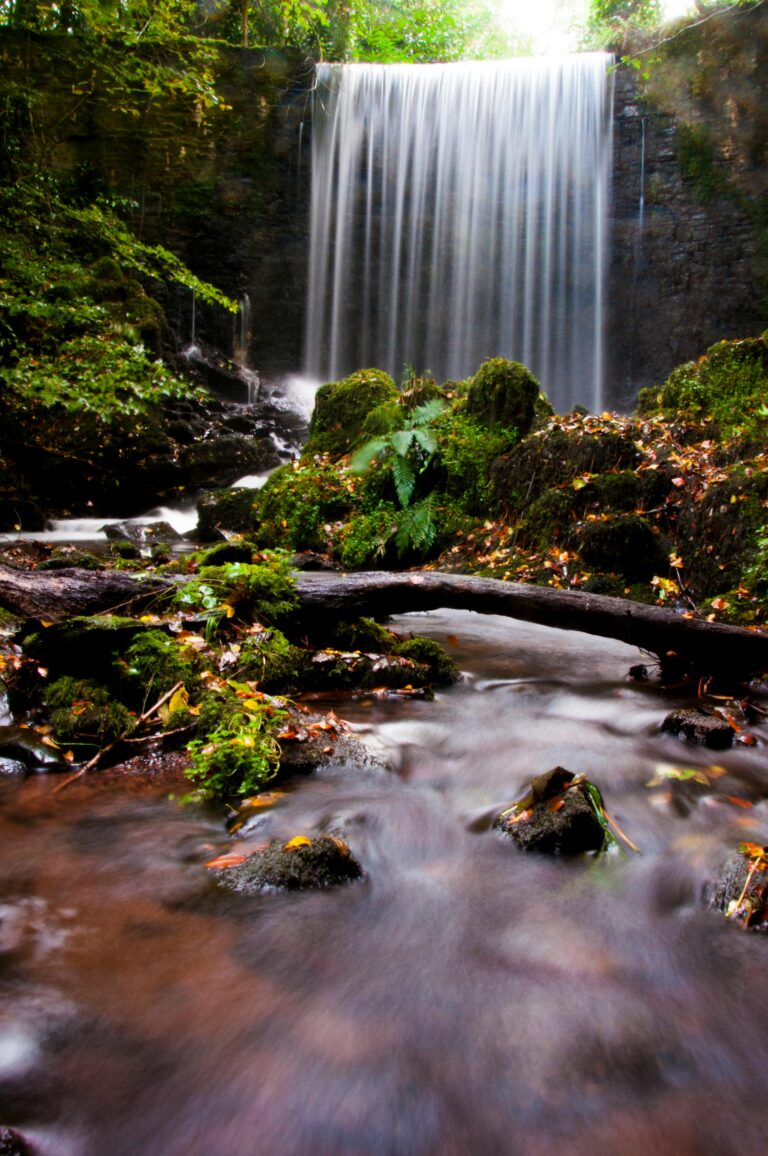
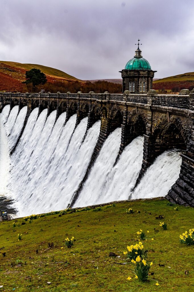
Mid Wales, often referred to as the “Green Heart of Wales,” is a vast and sparsely populated region that truly embodies the country’s natural beauty and tranquil spirit. Geographically, it’s dominated by the Cambrian Mountains, sometimes known as the “Green Desert of Wales” due to their wild, remote, and often treeless expanses. These rolling hills and sweeping moorlands are carved by deep valleys, where rivers like the Severn and Wye begin their journeys. To the west, the Ceredigion coastline offers a stunning contrast with its dramatic cliffs, golden sandy beaches, and vibrant seaside towns, forming a significant portion of Cardigan Bay. The southern reaches of Mid Wales also encompass a substantial part of the Brecon Beacons National Park (Bannau Brycheiniog), adding majestic peaks and captivating waterfalls to its diverse landscape.
Unlike South and North Wales, Mid Wales does not have large cities, fostering a sense of peaceful rural escape. Instead, it is dotted with charming market towns and historic communities that serve as local hubs. Aberystwyth, on the Ceredigion coast, is the largest town and a lively university town with a strong cultural identity. Further inland, towns like Llandrindod Wells (a historic spa town), Newtown (a former industrial hub), Machynlleth (a historic Welsh capital), and Brecon (gateway to the Beacons) offer unique experiences and act as welcoming bases for exploring the surrounding countryside. This is a region where the natural environment takes centre stage, inviting visitors to immerse themselves in outdoor adventures, rich history, and genuine Welsh hospitality.
Explore Mid Wales: Your Interactive Map Guide
Prepare to be captivated by the serene beauty and hidden gems of Mid Wales with our interactive Google Map! This page is your personal guide to uncovering the region’s best attractions, planning scenic routes, and ensuring an unforgettable visit.
How to Use Our Interactive Google Map:
Our map is powered by Google Maps, making it incredibly user-friendly and feature-rich. Here’s how you can navigate and explore Mid Wales:
-
Zoom In/Out: Use the
+and-buttons located in the bottom right corner of the map, or scroll with your mouse wheel, to adjust the level of detail from a broad regional overview to close-ups of specific towns and landmarks. -
Pan Around: Click and drag the map with your mouse to smoothly move across the terrain, allowing you to explore different areas of Mid Wales at your leisure.
-
View Information: Each significant destination is marked with a specially designated pin. Clicking on a pin will open an information box, providing a brief description of the location, its address, and often links to more detailed information, images, or official websites.
-
Get Directions: Within the information box of any pinned location, you’ll typically find a “Directions” icon (a small arrow). Click this to open Google Maps in a new tab, where you can easily generate precise directions (driving, walking, cycling, or public transport) from your current position to your chosen destination.
-
Change Map View: In the bottom left corner of the map, you can often switch between “Map” view (standard road map) and “Satellite” view (aerial photography), or even “Terrain” view, which highlights elevation and natural features.
-
Street View: For an immersive, ground-level perspective, drag the “Pegman” (the small yellow person icon, usually found in the bottom right or when zoomed in) onto a blue-highlighted street. This allows you to virtually explore streets and discover the immediate surroundings of a location.
-
Search within the Map: Although our map highlights key destinations, you can also use the search bar within the embedded map frame (usually at the top) to find any specific place, address, or type of business within the displayed region.
Map of Mid Wales