
Discover North Wales: An Interactive Map of North Wales
North Wales is a region of breathtaking contrasts, where towering mountains meet a stunning coastline, and ancient history is woven into a vibrant modern culture. Geographically, it is dominated by Eryri (Snowdonia) National Park, home to Yr Wyddfa (Mount Snowdon), the highest peak in Wales and England, along with a dramatic landscape of glacial valleys, pristine lakes, and rugged terrain. To the west, the Llŷn Peninsula juts into the Irish Sea, offering a more tranquil, Welsh-speaking coastal experience, while the Isle of Anglesey (Ynys Môn), separated by the Menai Strait, presents its own unique blend of sandy beaches, ancient sites, and maritime heritage. Eastwards, the landscape softens into the rolling hills of the Clwydian Range and Dee Valley Area of Outstanding Natural Beauty, before reaching the industrial and historic borderlands with England.
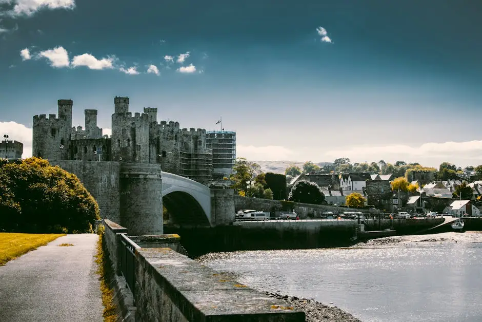
North Wales is home to several significant towns and two cities. Bangor, Wales’ oldest city, is a historic cathedral city and university town on the Menai Strait. Wrexham, recently granted city status, is the largest urban centre in the north-east, known for its industrial heritage and, more recently, its football club. St Asaph, the second smallest city in the UK, is home to a beautiful cathedral. Along the coast, popular Victorian seaside resorts like Llandudno and Rhyl draw visitors, while historic walled towns such as Conwy and Caernarfon proudly display their magnificent castles, part of a UNESCO World Heritage Site. This region is a stronghold of the Welsh language and culture, offering a rich and authentic Welsh experience alongside unparalleled outdoor adventure opportunities.
Explore North Wales: Your Interactive Map Guide
Get ready to immerse yourself in the epic landscapes and rich heritage of North Wales with our interactive Google Map! This page is designed to be your essential companion for discovering the region’s iconic landmarks, thrilling adventures, and hidden gems, helping you plan your perfect visit.
How to Use Our Interactive Google Map:
Our map is powered by Google Maps, making it intuitive and easy to navigate. Here’s how to make the most of its features:
-
Zoom In/Out: Use the
+and-buttons (typically found in the bottom right corner of the map frame) or your mouse’s scroll wheel to zoom in for detailed views of specific towns and attractions, or zoom out to see the entire North Wales region. -
Pan Around: Click and drag the map with your mouse to move across the area, allowing you to explore different counties, coastlines, and mountainous regions.
-
View Information: Each key destination is marked with a distinctive pin. Click on a pin to reveal an information box that includes a brief description, address, and often links for further details, images, or official websites.
-
Get Directions: Within the information box for a pinned location, you’ll usually find a “Directions” icon (often a small arrow). Click this to seamlessly open Google Maps in a new tab, where you can generate precise directions (driving, walking, cycling, or public transport) from your current location to your chosen destination.
-
Change Map View: In the bottom left corner of the map, you can often switch between “Map” view (standard road map) and “Satellite” view (aerial imagery) for a bird’s-eye perspective, or even “Terrain” view to highlight topographical features like mountains and valleys.
-
Street View: For an immersive ground-level experience, drag the “Pegman” (the small yellow person icon, usually located in the bottom right corner or accessible when zoomed in) onto any blue-highlighted street. This allows you to virtually walk around and see what the surroundings look like.
-
Search within the Map: While our map highlights key attractions, you can also use the search bar directly within the embedded map frame (typically at the top) to search for any specific address, business, or landmark within the displayed region.
Map of North Wales
